
Austin’s Elevation: Exploring the City’s Heights
Austin has a story that goes back over 10,000 years. It became a city focal for government and learning in the 1800s. Now, known as the Live Music Capital of the World, it is home to folks from all walks of life. The University of Texas at Austin adds to its shine. Its elevation varies from 425 to about 1,000 feet above sea level. This gives Austin unique natural sights to explore.
The city’s height makes it more prone to wild weather like flash floods and tornadoes. Yet, its mix of flat and hilly lands, and cool lakes, offer many fun spots. Think of Lady Bird Lake and Lake Travis. Austin is a bustling place, with tech giants and top businesses moving in.
Key Takeaways
- Austin’s history spans over 10,000 years with a rich cultural heritage.
- Elevation in Austin ranges from 425 to 1,000 feet above sea level.
- The city is located in Central Texas’ Texas Hill Country.
- Weather extremes such as flash floods and tornadoes are more likely due to elevation.
- Lakes like Lady Bird Lake and Lake Travis offer recreational activities.
- Austin is a significant hub for technology and business, including several Fortune 500 companies.
Understanding Austin’s Geographic Location
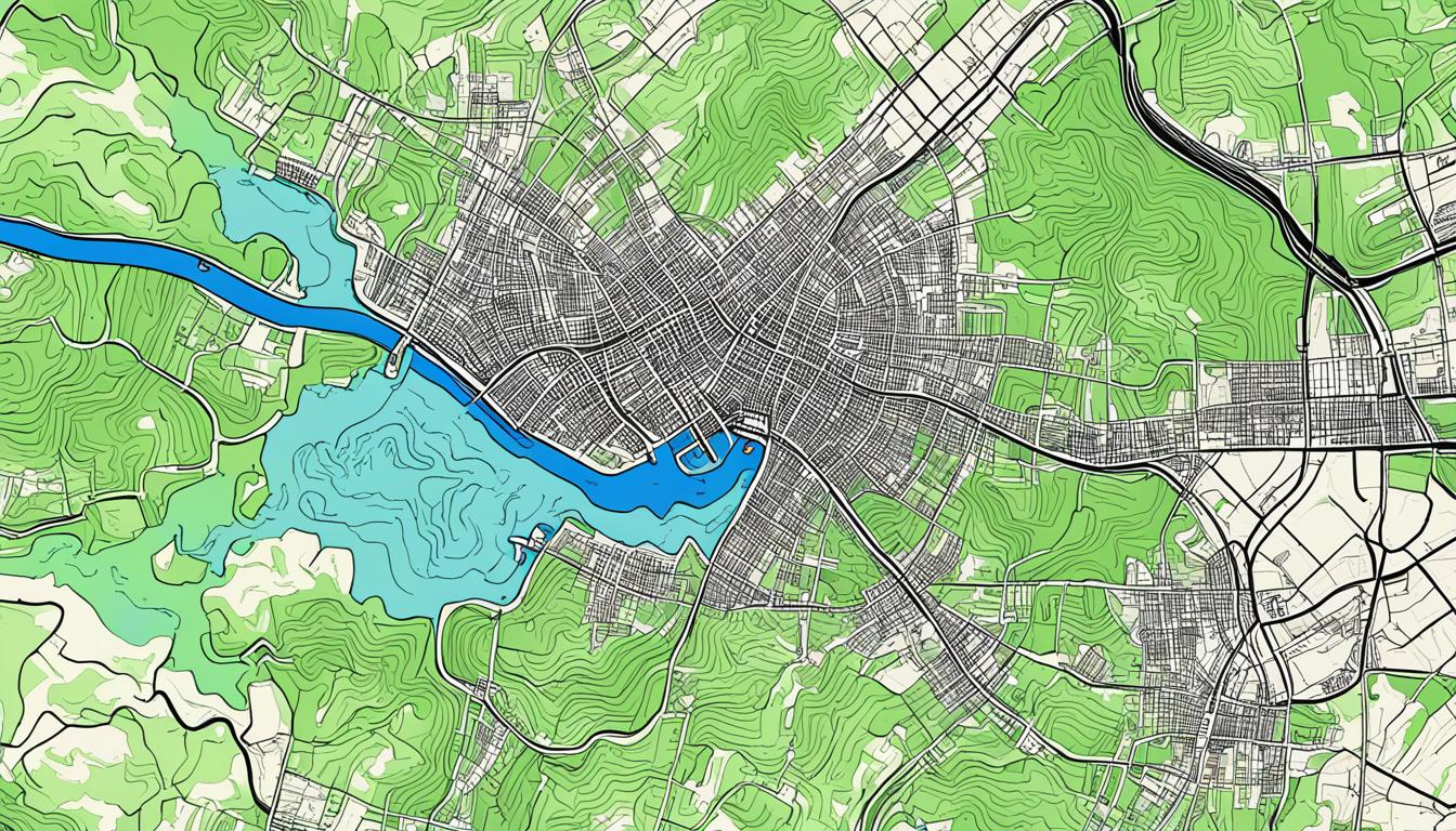
Austin sits in the Texas Hill Country, setting it apart from other cities. This location makes Austin look like a picture, with hills changing into flat lands. The city’s geography affects its culture and how it faces certain weather patterns.
The Texas Hill Country
The Texas Hill Country greatly influences Austin’s look. It’s famous for its rolling hills and lush valleys. These features shape Austin’s beauty and its exposure to weather changes and natural disasters.
Significant Lakes
Many big lakes in Austin add to its beauty and fun activities. Lady Bird Lake, Lake Austin, and Lake Travis are on the Colorado River. They offer lots of water sports and fun for people living in or visiting Austin. The way these lakes meet the Hill Country’s elevations is a critical part of Austin’s life and how it deals with floods.
Austin’s Elevation Range and Topography
Austin’s elevation profile shows a wide range of heights. This creates different landscapes and unique features. The austin topography varies a lot, influencing how people live and the city’s look.

Flat Eastern Areas
The eastern part of Austin is mostly flat. It has soils rich in clay and loam. This differs from other areas. These flat lands are good for farming and houses. But, the low elevation means poor water drainage. This makes floods more likely during heavy rain.
Hilly Western Suburbs
The western suburbs, however, are hilly and elevated. They sit on the edge of the Texas Hill Country. This area has rolling hills and beautiful views. The different austin terrain elevation means more fun outdoors. It’s great for hikers and bikers.
The changes in elevation also make natural paths. This adds to the area’s beauty and fun. Plus, these hills help water drain away. This means less flood risk than the flat east.
The mix of flat eastern areas and hilly western suburbs shapes Austin’s look. It also affects how the city is built and prepares for disasters. Knowing about the austin elevation profile helps manage these challenges and benefits.
Notable High Points in Austin
Austin has many high spots that offer beautiful views and fun things to do. One standout is Mount Bonnell. It sits 775 feet above sea level, making it the highest point in Austin within the city limits.

Mount Bonnell Activities
Mount Bonnell is known for its stunning views. You can see the Colorado River, the Texas Hill Country, and the Austin skyline. It’s a favorite place for people from out of town and those who live nearby. Here are some things you can do there:
- Hiking along the Mount Bonnell trail, which is popular with people who love to stay active.
- Enjoying mountain biking, which has both fun and challenging trails.
- Sitting back and taking in the amazing views of Austin’s varied landscape.
It’s the perfect place to go for outdoor fun or to see Austin’s high points. Mount Bonnell lets you see Austin from a special, elevated viewpoint.
Austin Elevation’s Impact on Weather and Climate
Austin’s heights go from 425 to about 1,000 feet above sea level. These heights, with its spot in Central Texas, affect its weather and climate a lot. They make Austin more at risk of some weather, making it hard to predict what the climate will be like.
Flash Floods
Austin faces many flash floods due to its heights. When it rains hard, water flows fast, sometimes causing dangerous floods. The flat east and hilly west parts can fill with water quickly, leading to big floods without much warning. Because of these features, Austin needs strong plans to deal with floods and keep people safe.
Severe Weather
Austin is near Tornado Alley but sees fewer tornadoes than some Texas areas. But it still has its share of severe storms. The city’s increased heights and sometimes dry weather can lead to wildfires, like in 2011. To be ready for disasters, Austin must consider its elevation carefully and plan well to face various severe weathers.